Posts

Showing posts from 2015

We are home!

We left Eureka in the fog and headed down 101 cutting over at Legett to Hwy 1. Total mileage for this trip...3010, 5 states and Alberta Canada. (we sorely missed our 4 legged traveling companion noting where she would have liked to stop, and how she made her wishes known. She was the best speed governor, she would turn and 'stare' at John if he was going to fast. <3)

Another day gobbling up the road

Started out driving the 'Oregon outback' Scenic Byway. Goose lake looked pretty dry. Our highest pass was Aden Pass at 5173'. There was a wind farm on the ridge outside Burney CA. At 600' near Redding it was 100 degrees. We decided to forgo the I5 corridor and headed toward Eureka on 299. There had been a number of warning signs about 2 hour delays because of roadwork. We lucked out and never had to stop for more than 10 minutes or so. A late lunch put us past the 3pm stop time. It looks like they are widening and straightening the road in various places. Heading toward the coast, the fog was a welcome sight the last ridge line in at Blue Lake. We are at the KOA in Eureka having covered 365 miles. I am looking forward the breakfast...I yelped a couple of places that look really good.

My Shasta from CA 299

Image

Dry Goose Lake CA

Image

Rim oasis RV park lake Abert Or

Image

Day 13 ... drive, drive, drive.

Covered 396 miles today following 95 along the edge of 7 Devils Wilderness Area. We crossed the 45th parallel in the morning watching the landscape slowly change from woods to high desert scrub. We went through fields of onions, corn and hay. Our highest pass was 4848' and we saw coyotes both alive and as road kill. It stayed around the high 80's dropping to the low 70's after the sun set. We are at 4545' so it should cool off nicely to sleep. We passed several alkali flats and a Lake Abert that looked almost dry. Coming back a different way has led to the discovery of areas we have never been to. Onward to California gold country tomorrow. Both the highways we were on today US 20 and 395 had little traffic (it was Sunday) and had even been paved recently. We spent most of the day without a center line.

Heavens Gate Lookout in Seven Devils-Hells Canyon Wilderness

We had spent the night on the Salmon River and decided to check out the 'Hells Canyon Wilderness Area' we were driving through. There was an office close by. After talking to the volunteer in the office we headed out to the Seven Devils Campground. Driving 20 miles we gained over 6000' in elevation. Riggens was at 1800' and the Heavens Gate lookout Station is 8249', looking out on 4 states and two mountain ranges. We hiked a bit, but being flat landers at high elevation, it was slow going. There had been a fire here in 1987. There are still many weathered tree trunks standing in the rocky soil. We stayed in the parking lot as the campground was down in a hole. We met several young men who were either getting ready to hunt elk with long guns in October scoping out where they were, or carrying crossbows which season is currently open. Last night two of the men had stood until sunset with binoculars and scope looking for elk in the valley below. They hoped

Sunset panorama

Image

Seven Devils

Image

Looking toward Oregon and Washington

Image

That's us!

Image

Up to a fire lookout

Image

Interpretation...18 mile gravel road in.

Image

Top of the World Hells Canyon

Image

Heavens Gate at Hells Canyon Idaho

Image

Day 10

As we headed away from the Flathead Lake a bear loped across the road and into the bushes roadside. We crossed into Idaho at Lolo Pass, 6200', 41 degrees. We followed the Lewis and Clark Trail for awhile. All day there was 'weather' ranging from light rain to heavy with hail. There were patches of snow along White Bird Summit, 4245'. We are spending the night in Riggins Idaho along side the Salmon River. ---

Looks cold! It's 45 here at 3000'

Image

Rocky beach

Image

Sunrise Flathead Lake

Image

The sun came out!

Image

Wednesday the 16th

We are parked in Blue Bay Campground, beside Flathead Lake. The weather chased us out of Glacier. Between rain and sleet, staying anywhere and hiking did not appeal to either of us. We did make the rounds of the eastern boundary, coming back from Alberta. The road into Many Glacier was rough with patches of gravel in spots. Coming down through St Mary and cutting through at Hwy 49 to Two Medicine, the scenery was spectacular. Goat Lick was closed because of the recent Sheep Fire. We came down the Flathead Lake on the opposite shore we went up. We decided to stay here for a couple of days and then head south, homeward. I am looking forward to eating at a Cracker Barrel in Missoula.

Hwy 49 panorama (Two Medicine) 4

Image

Hwy 49 panorama (Two Medicine) 3

Image

Hwy 49 panorama (Two Medicine)

Image

Hwy 49 panorama (Two Medicine) 2

Image

Many glacier lodge 1, starting to sleet

Image

Many Glacier 2

Image

Rough road into Many Glacier.

Image

Where the plains meet the mountains

Image

Montana cattle on their way to breakfast.

Image

Panorama 2

Image

Panorama 1

Image

Mountain tops with fresh snow, leaving Waterton.

Image

The boat, the ranger station and John.

Image

An International Peace Park

Image

Goat Haunt 2

Image

Goat Haunt Ranger Station

Image

On the boat across Waterton Lake. The Continental Divide

Image

Waterton Alberta Canada

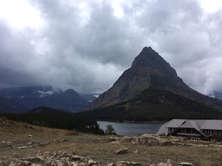
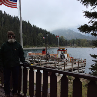
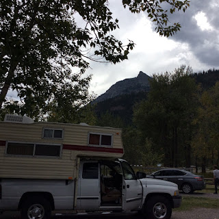
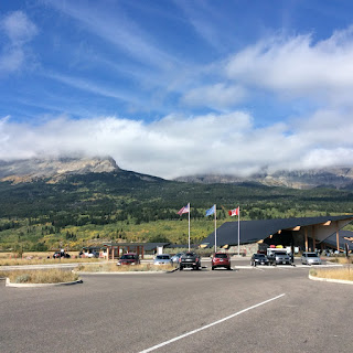
Glacier National Park has a companion park on the Canadian side. We are staying a couple of nights at the Waterton Townsite Campground. 
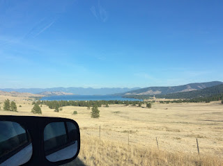
Today plans are for a boat cruise around Waterton Lake mostly in Canada, to Goat Haunt, a site on the US side, and back. 
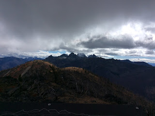
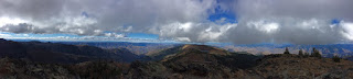
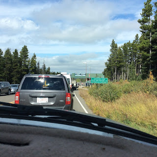
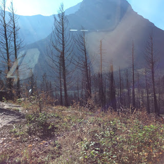
We took the Going to the Sun Road from west to east yesterday and all the parking lots were already full by 10am on Sunday. I can't even imagine what it would be like during the busy summer months. I think we may go back along the eastern edge of the park on our return. There is some beautiful rock work along the cliffs, done in the CCC days. Compared to our drive up the coast, this was pretty tame, except of course the rugged mountain tops towering over us. We are getting some nice fall colors too. Money is a bit confusing. They take US Dollars and make change in Canadian.

Sunset 2

Image

Waterton sunset.

Image

Home Sweet Home...Waterton Townsite CG, right by the lake

Image

Canadian Rockies

Image

Headed into Alberta Canada

Image

St Mary Visitor Center

Image

ST Mary Lake

Image

Reynolds Creek Fire, St Mary Lake

Image

Looking back at Sun Road, red dot far right, tour bus

Image

Stop for breakfast at top of loop

Image

Rock wall along road

Image

Tunnel Going to the Sun Road

Image

Beginning of Fall color

Image

Onward to Glacier National Park

Our goal today is to head for the east side. Hopefully the going to the Sun Road is open all the way and our rig is right sized. 'Glacier Campground' has been a pleasant interlude. We had a squirrel come right up onto out table last night and try to get in one of our mugs. He ended up knocking it over which then scared him away. Pretty tame little critter, we weren't 2' away from him. They have a campaign both in print and radio about 'a fed bear is a dead bear.' We are very close to train tracks and several times a day and night we hear the whistle blow for the towns it goes through in both directions. Woeful sound.

The sun setting in our campground.

Image

Buffalo cafe

Image

Whitefish Montana

Image

#4...just wandering around

It was a good decision, avoiding Missoula! We explored Kalispell, buying ice and groceries. We got to go to a Noon meeting and had lunch at an old fashioned soda fountain type place. I explored downtown art gallery/co-ops. Lots of wonderful eye candy. We are set for two nights at a nice quiet campground between Columbia Falls and West Glacier. The Flathead Valley is beautiful. We will explore more tomorrow.

Day 3...in Montana near Flathead

We covered 435 miles traveling through fields of hay, field corn and fruit orchards. Crossing Idaho into Montana took us along river valleys and into more forested terrain, which opened up into rough looking cattle grazing. We are spending the night at West Shore State Park on the Flathead Lake. My original plan was to spend the weekend in Missoula. After wandering around Spokane and Cour d'Alene I had had enough of urban environments! So we headed north. Luckily we were able to make reservations for the weekend in West Glacier at Glacier Campground. Looking at the local paper, there is plenty to do to keep me occupied.

1st look at Flathead Lake

Image

Day 2

We followed US 97 steadily N/NE watching the land change from forest at 4500' to high desert buttes under 2000'. The landscape after crossing the Columbia River looked a lot like Nevada. There was a huge wind farm at the OR/WA border. The Yakima Nation RV Campground has a really strong wi if signal :-). Mileage for the day: 340. (Thanks to Barbara and Jerry for our space last night and breakfast this morning.) Onward tomorrow to Missoula, unless we get distracted along the way.

Columbia 2

Image