Posts

Showing posts from October, 2011

Gualala!

The wind blew all night! We had a high wind warning as we started through the Tehachapi Pass. Lots of ups and downs...summit of Tehachapi pass 4064 down to 12' below sea level on highway 12. As we approached Bakersfield there was a brownish haze on the horizon and the radio reported an unhealthy air quality of 101. We saw a helicopter spraying crops around the time we entered Northern CA according to the map at Merced. On a Valley radio station the announced a stay at the Flamingo Hotel as a contest prize. At atwater, we could smell the garlic! Along Highway 12 there were egrets and herons airborne and hunting in the marshes. We were pleasantly surprised that the highway above Jenner Grade was open to two way traffic. We drove a total of 7,978.5 miles. I am so glad to be home.

Home!

Image
The Gualala River Bridge

Blades for Wind Generators

Image

High Density of Wind Machines

Image

California!

We woke up to frost in Flagstaff this morning. There were a lot of ups and downs today, starting out at 7300', dropping down to 500', and going back up to 3000' in the 'high desert' of California. Crossing into California and Pacific time, we had to stop at the Inspection Station where they asked us about not only fruit and veggies, but plants and firewood too. The interstate is seriously deteriorated here. We turned onto 58 just past Barstow which isn't in very good shape either. There were two pretty good sized solar installations along the way and a wind farm not to far away from where we are stopped, Mojave CA. We drive across the Mojave desert, with it's assortment of cactus and unusual plants. I hear it is raining at home.
Sunset in Mojave CA

Image

Solar Installation outside Daggett CA

Image

Interesting Rock Formations (and a Wind farm)

Image

Major Cuts for this Highway

Image

Kingman AZ

Image

Interesting Buttes

Image

Flagstone Capitol of theWorld

Image

Day 34

We crossed the Rio Grande River leaving Albuquerque. A couple of hours later we entered Arizona. We are avid readers of Hillerman novels and the scenery proved to be as he describes. The dirt roads and washes that people drive down, the individual homes far apart from each other was readily recognizable. Every few miles there were 'Indian' trading posts selling everything from knives and pottery to 'authentic' rugs, blankets and jewelry. Upon closer inspection the inventory is usually half locally made and half 'made in china.' We are spending the night in Flagstaff, about 1000 feet higher than Albuquerque. A nearby peak is over 12 ,000 feet, with snow on top. It is supposed to get down to 25 degrees tonight! Brrr.

Coal Power Plant

Image

Every Exit Has One

Image
An Indian Trading Post with knives, pottery, blankets, moccasins, and 'authentic' indian jewelry.

Reminder that Dinosaurs once roamed this land

Image

Early Morning Wedding

I didn't get quite the early start this morning, so by the tme I got to the field they were halfway through their marriage vows. There were 10 balloons inflated and ready to launch just before dawn. With the final exchange they lifted off. When all were several feet in the air they did a 'twinkle glow' which was very striking in the velvet sky.  There seemed to be even more balloons today than yesterday going up. Some are headed for Gallup to fly in the Red Rock area. Many of the vendors were making deals on all things balloon. I of course added to my wardrobe. I was tired before we got here and I am really exhausted now!  We are watching the RV's leave, slowly but surely. Everyone here was friendly and helpful. It is quite a feat to pull this off...one that they have had 40 years of practice. Onward toward home. Watching everyone leave reminded me of seeing vehicles coming back from Burning Man as we were heading out in September. They were a more motley collection tha...

Roof of the RV

Image

Last Day

Image

Great Day For Flying

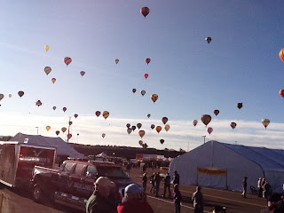
It had stopped raining and the winds seemed gentle at 4:30 this morning as I headed for the launch area. Being that early, security isn't what it will be, so I got back into the pilots area. When I saw the two tables of Zebras ( ground referees) I figured it would be a day for flying. Many had accessorized their black and white attire with pink, (I am guessing to honor the fight against breast cancer.) A large part of the fun here seems for participants and observers alike to wear wildly silly and extravagant head gear. The Dawn Patrol lit up the sky, followed by the Morning Glow. As the sky lightened the damage done to the fields by the rain became apparent. Many of the rigs had driven into a soggy mess and we watched a couple get pulled out. Many of the balloons were rolled out on tarps to keep them clean. Small toy balloons were released to check out the wind currents. As it got lighter it became apparent why it was so cold. The mountains were covered with snow! More and more ba...

Special shapes

Image
ChickABoom, Uncle Sam, shark, spider pig, Wells Fargo wagon.

More Ready to Rise.

Image

Balloons Everywhere!

Image

Zebra

Image
Zebra's are field referees. They direct traffic both on the ground and when to go up into the air.

Snow! No Wonder It's Cold.

Image

Yup, I am here!

Image

Snow on the Mountain.

Image

Dawn Patrol Launch

Image

Zebras!

Image

Started at 4:30!

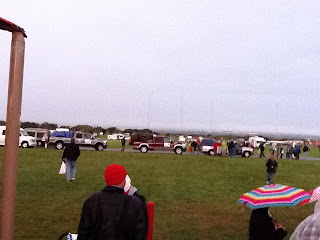
John said I must be serious to get up THAT early! It had been raining since about 2:30am so not much happened on the launch field. I was lucky to catch a shuttle within a few feet of the RV so I barely got damp. Walking around the Main Street was fun, both checking out the merchandise and people watching. I crashed the pilots tent, where there was coffee, tea and cocoa, along with Belgium waffles, chili, and krispy kream donuts. I found a Bad Ass Coffee booth in the artist pavilion. Hopefully tomorrow will dawn clear and with no winds. We are paid through Sunday! Drove over to Old Town and got my shopping fix, found a grocery store and a brand new Goodwill store nearby. Now we are off to find a McDonald's for wi-fi (and an Oreo flurry.)

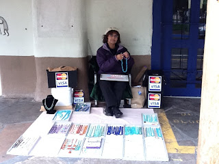
Street vendor accepts visa and mc.

Image

Old Town Albuquerque

Image

Desert colors

Image
Even the highway interchanges are pink and turquoise. Lots of art scattered around too.

1598 (3)

Image
I cannot even imagine crossing this country like this.

1598 (1)

Image

1598 (2)

Image

One balloon decided to inflate

Image

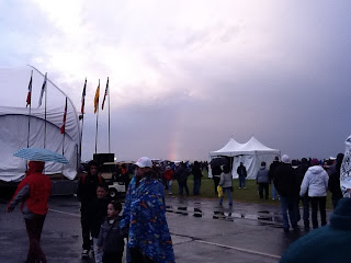
Rainbow!

Image
Good news/Bad news

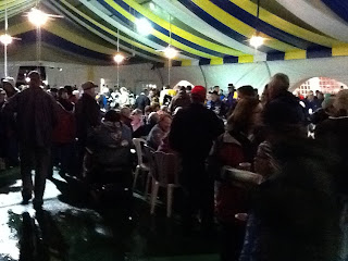
The Pilots Tent

Image
I crashed the Pilots tent...it was raining so not much outside activity.

Still raining!

Image

Rough Day

John had to fight 35 mph winds all the way today, complicated by the higher altitude. We ate lunch at 5900' and topped out at close to 7000'. We passed lots of wind generator farms. The trees that were along the road definitely had a northern list to them. We passed many abandoned grain coop elevators along with gas stations and restaurants no longer in operation. There was a "Happy Tracks Horse Motel" along the interstate. Texas didn't have rest stops, they only had parking or picnic areas. I noticed rock mesas appearing at about 4200' and the landscape started showing prickly cactus looking plants and yucca, some still in bloom. We crossed into New Mexico and Mountain time surrounded by empty land horizon to horizon. In a town called Santa Rosa on Route 66 we crossed the Pecos River. Albuquerque is nestled at the foot of the Sandia mountains. We are spending the night dry camping on the Balloon Fiesta Grounds. I am 1.5 miles from the launch site. It is prett...

Balloon Fiesta On Site RV Parking

Image
Dry Camping within walking distance of the Balloons. The launch field is behind the round building on the right.

New Mexico, Land of Enchantment

Image
There are wind generators on top the far Mesa. John is driving into winds 35mph and it is hard work! Stopping, we have to brace ourselves to open the trailer door. The constant movement is bothering Zoe. She wants to be in my lap.

Day 30

We crossed the Arkansas River again and I saw my first Oklahoma oil well. The interstates are in really poor shape and they are working on them all along the way. In one area the concrete they had removed from the road bed was being crushed on site and being reused as gravel for the road bed. In Oklahoma there seemed to be a casino every 40 miles or so, with a Cherokee Gift Shop at every 2nd or 3rd exit. We started catching a head wind about midway across the state with a light rain chasing us most of the afternoon. There seems to be a Route 66 museum in every town too. The native landscape gradually changed to scrub and red dirt as we climbed to over 3500 feet into the high plains of Texas. We are spending the night in another KOA campground. I probably would have saved what a membership card would have cost early in the trip. Radio has been pretty limited to FM ranging from Christian to Christian to country western to Christian and country western. I am surprised at the lack of AM.

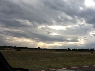
Stormy Oklahoma Texas Sky

Image

Oklahoma City

Image

Onward from Graceland

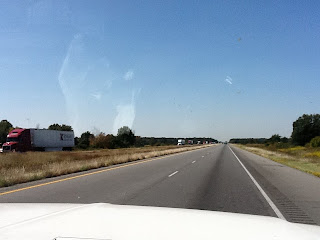
Could not come to Memphis and not drive by Graceland...right? $15 later for parking an oversize vehicle, I got close enough to take a picture from the street. It does not seem like the income generated by the Elvis Machine is benefitting the neighborhood. As far as the whole commercialization of 'the king' I felt sad looking around at all the stuff for sale, as his singing followed me from place to place. We just cut across the corner of Tennessee at Memphis, before heading into Arkansas. There was a deep smog layer hanging over the city as we drove away from Graceland. We got to cross the Mississippi river again, very wide and very muddy looking. There wasn't anyway to get down to it from where we crossed. I am not the happiest camper traveling the Interstate. The highways are in abysmal condition either jerking you along concrete sections or full of potholes, not to mention trucks, trucks and more trucks! I did see some swamp along the way, with Cypress trees, their knees...

Oklahoma!

Image

Churches on steroids!

Image

Crossing the Mississippi

Image
There didn't appear to be any way down to get by the river where we were. It was wide and muddy.

Lots and lots of trucks!

Image

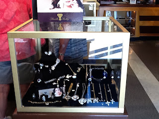
Can,'t forget the line of jewelry

Image

The writing on ALL the walls

Image

Even an airplane tour

Image

Graceland

Image
As close as one could get for free. (we had to pay $15 to park!)

Day 28

The morning started off a chilly 49 degrees inside the trailer. We weren't on the road too long before I saw my second road kill armadillo. Not long after that we crossed into Alabama and Central time. The logging here appears to be of the clear cut variety and the logs are skinny poles, perhaps 10 years growth. I am told they are used to make pulp for paper. There were lots of fireworks outlets as soon as we crossed the border. We crossed into Mississippi and drove through Tupelo, birthplace of Elvis. There was a very large Toyota factory in Blue Springs MS. There is a vine that seems to grow on everything. I wonder if it is kudzu? Ended up in tennessee, not to far from Graceland. As we skirted Memphis, on our way to the campground, we could have been anywhere in the country. Short of a few different chains, all the Strip malls look the same. Onward toward Arkansas and Oklahoma.
Alabama Cotton Field

Image

Welcome to Alabama

Image

Georgia

We made it as far as Atlanta Georgia. We crossed the Savannah River into Georgia and drove along Lake Oconee. The lake had houseboats on it. We are crossing the Great Smockey Mountains, the highest pass so far is 905 feet. When we stopped for lunch I noticed that the Georgia accent is a bit softer. We lost over an hour to road construction. The campgdround we found had been flooded out during Katrina and has not yet been fully restored. During our stay in SC a women was asking me about my tattoo's. I found out that it has only been two years since they have even been legal! I had noticed that there weren't as many inked folks as I see in CA. Turns out the bridge we crossed back in Virginia is one of the 7 engineered wonders of the world. 20 miles long, it has two mile long tunnels and two manmade islands 5+ acres each. It was where we had to make sure our propane was turned off, to go through the tunnels. Next time I have Internet (and I remember) I am going to look up a couple...

An auspicious start

Image
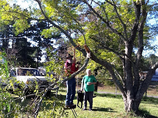
Couldn't wrangle the trailer between the tree limb and the garage, so he cut off the tree limb!

Eleven States

Eleven states between here and home! Working on our return route today...looks like mostly interstate, I40 and US66. The only place I want to visit is Albuquerque NM. The Hot Air Balloon Festival may still be happening. Latest check of the weather shows it is still hot in Texas and Oklahoma. John has enjoyed visiting his sister. They hadn't seen each other since 1997. I really haven't much else to report, so will stop while I am ahead. We are hitting the road tomorrow morning.